Map Data
 Mapping data for the US is available FREE from Advanced Flight every 28 days for AF-3000, AF-4000, and AF-5000 Series users with the mapping add-on key purchased with your EFIS (Verify this key on the ABOUT page). These updated contain the current airports, airspaces, and obstacles.
- Right click and "Save Target As..." to download files
- Be sure to extract all files from there zipped file when updating.
- Verify that the files are copied to the root directory (ie: X:\ ) of the storage device. Additional folders will not work.
- Mapping is a add-on feature and requires a key for activation. Verify this key on the ABOUT page of your screen.
- Map Version must be less then or equal to MV at the end of the system software version (i.e. MV15 works on a MV16 systems)
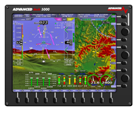
AF-5000 Series
Only ONE USB memory stick labeled AFS_DATA per EFIS may be used at a time.
If you are also using an SD Card ensure the SD Card is NOT named AFS_DATA.
Aviation/Obstacles Database for US Customers
The following United States and Territories data is released on the FAA standard 28 day AIRAC cycle. This is the most comprehensive data available for the US, including current airports, airspaces, and obstacles. The best part is it's free! Map Data can be loaded using the USB memory stick or SD Card.
Geo-Referenced Charts and Airport Diagrams
For US customers, chart data subscriptions, including sectionals, IFR low and high en-route charts, procedure charts, airport diagrams, and flight guide. Unlike other databases that are stored in display’s internal drive, charts and airport diagrams, because of their large size, must be stored on a USB memory stick that remains connected to the display during use.
Base Map / Cultural Data - Worldwide by Region
These databases improve on the previously available base map by adding worldwide roads, rivers, and city/state/country borders. The North American region is pre-installed on AF-5000 displays that have 10.00.00 or newer software shipped from AFS. All other displays, including those that are being upgraded from earlier versions of software, should select and download the appropriate database from this page:
 Base Map / Cultural Data
Updated June 2013
Terrain Databases - Worldwide by Region
There are three resolutions of terrain that all need to be installed to show terrain properly at all map range levels. Each AF-5000 display will need a USB memory stick loaded with High Resolution Terrain for your region. AF-5000 displays that have 10.00.00 or newer software shipped from AFS come pre-installed with worldwide low and very low resolution terrain. All other displays, including those that are being upgraded from earlier versions of software, should select and download the appropriate database from this page:
- Terrain Databases
Updated August 26th 2014
AF-4000 Series / AF-3400s / AF-3500s
The following United States and Territories data is released on the FAA standard 28 day AIRAC cycle. This is the most comprehensive data available for the US, including current airports, airspaces, and obstacles. The best part is it's free!
AF-3/4000 Series require 3 map files (AF2MAP**.AFM, AF2TER**.AFM, AF2VEC**.AFM). You will need the full download if you are missing AF2TER**.AFM or AF2VEC**.AFM.
| Version | Full Download | Map Only | Valid |
| 16 | Map Data Files (Map, Terrain, Vectors) AF2, MV16 |
Map Data Update AF2, MV16 |
Valid June 22nd to July 20th 2017 |
Geo-Referenced Charts and Airport Diagrams
For US customers, chart data is available by subscription. Unlike other databases that are stored in display’s internal drive, charts, because of their large size, must be stored on a SD Card that remains inserted into the display during use.
AF-3000 Series Map Files (Non 's' CPU)
The following United States and Territories data is released on the FAA standard 28 day AIRAC cycle. This is the most comprehensive data available for the US, including current airports, airspaces, and obstacles. The best part is it's free!
AF-3000 Series require 3 map files (AFSMAP**.AFM, AFSTER**.AFM, AFSVEC**.AFM). You will need the full download if you are missing AFSTER**.AFM or AFSVEC**.AFM.
| Version | Full Download | Map Only | Valid |
| 15 | Map Data Files (Map, Terrain, Vectors) Non 's' CPU, MV15 |
Map Data Update Non 's' CPU, MV15 |
Valid June 22nd to July 20th 2017 |
Geo-Referenced Charts and Airport Diagrams
For US customers, chart data is available by subscription. Unlike other databases that are stored in display’s internal drive, charts, because of their large size, must be stored on a SD Card that remains inserted into the display during use.
Alternative International Mapping Databases
 PocketFMS AeroData provide all the important reference objects required by a VFR pilot and shown on paper charts - and a lot more. Unlike paper charts, PocketFMS data provides seamless, worldwide coverage, and can be refreshed at any time, any number of times. Data is organized into ICAO Flight Information Regions (FIRs, ARTCCs in the USA), which for ease of download are also grouped into the major geographic regions - Europe, Continental USA, Canada, and Australasia.
Works with the AF-3000s, AF-4000s, AF-5000 Series
Read More
 Jeppesen avionic data powers all Advanced Flight EFIS models.
Providing you with vital knowledge of airport features, runway characteristics, communications information, waypoint features, VORs, NDBs and a comprehensive set of boundaries for controlled/restricted airspace.
As well as obstacle data consists of man-made features such as cell phone towers, radio towers, buildings, cranes and ships.
Updating your avionics data is easy with Included Services Update Manager (JSUM).
Jeppesen avionic data powers all Advanced Flight EFIS models.
Providing you with vital knowledge of airport features, runway characteristics, communications information, waypoint features, VORs, NDBs and a comprehensive set of boundaries for controlled/restricted airspace.
As well as obstacle data consists of man-made features such as cell phone towers, radio towers, buildings, cranes and ships.
Updating your avionics data is easy with Included Services Update Manager (JSUM).
Works with the AF-3/4/5000 Series S and Non-S, ask for Advanced Deck Data
Read More